Meet Lindsey the GIS Specialist
Have you ever found yourself struggling to tell other people what your profession as a GIS specialist or surveyor actually entails? If so, you’ll no doubt be interested to hear about a great new too...

Have you ever found yourself struggling to tell other people what your profession as a GIS specialist or surveyor actually entails? If so, you’ll no doubt be interested to hear about a great new too...

ClearEdge3D, makers of the Verity software, has announced a collaboration with Gexcel, makers of the HERON wearable scanners. The two companies have joined forces to make it even quicker and easier f...

Aizawa Concrete Corporation has announced a strategic partnership with Top Flight Technologies, a leading provider of heavy-lift, long-range (HLLR) hybrid-electric unmanned aerial vehicle (UAV) techno...

Huge amounts of data from space are produced daily by the Copernicus Earth observation (EO) programme and its Sentinel satellites. This big data from space, including information on the Earth’s atmo...
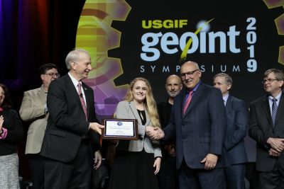
At the United States Geospatial Intelligence Foundation’s (USGIF) GEOINT 2019 Symposium, Jaclyn Guz was recognized as the recipient of the Stu Shea USGIF Endowed Scholarship. Guz is a student at Cla...
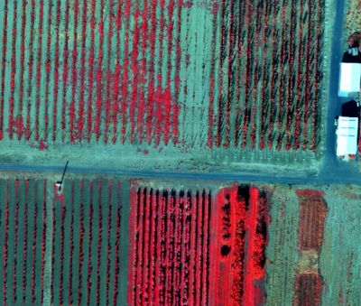
SimActive, one of the leading developers of photogrammetry software, has released Correlator3D version 8.2 with advanced processing capabilities of multispectral imagery. Supported sensors include th...

At the recent SPAR 3D & AEC NEXT conferences in Anaheim, California, USA, ClearEdge3D, maker of EdgeWise, Verity and Rithm for Navisworks software, announced a collaboration with Gexcel, maker of HERO...
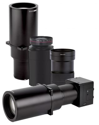
Phase One Industrial has expanded its RS and RSM lens offering with three new high-performance lenses for high-altitude aerial photography and long-range aerial and ground inspection applications. The...
Glanville Environmental, including its specialist survey division Glanville Geospatial Services, has announced that it has been accepted as an Affiliate Member of The Survey Association. Glanville Geo...
In advance of the transition to Next Generation 9-1-1 (NG9-1-1), San Mateo County, California, has commissioned DATAMARK, the public safety GIS business of Michael Baker International, to complete a...
This site uses cookies. By continuing to use this website, you agree to ourCookies Policy.Agree